Founded in 2018, we are an independent research collective of scientists and engineers working across universities, research institutes, industry, and government on four continents. We study how water shapes, and threatens, life in mountain regions. Our work spans floods and flash floods, landslides and debris flows, glacial lakes and their outburst floods, groundwater, wildfire–hydrology interactions, and the resilience of communities and infrastructure.
We combine process-based understanding with artificial intelligence and remote sensing to advance hazard and water science in data-scarce mountain environments. We also mentor young scientists and support the next generation of mountain researchers.
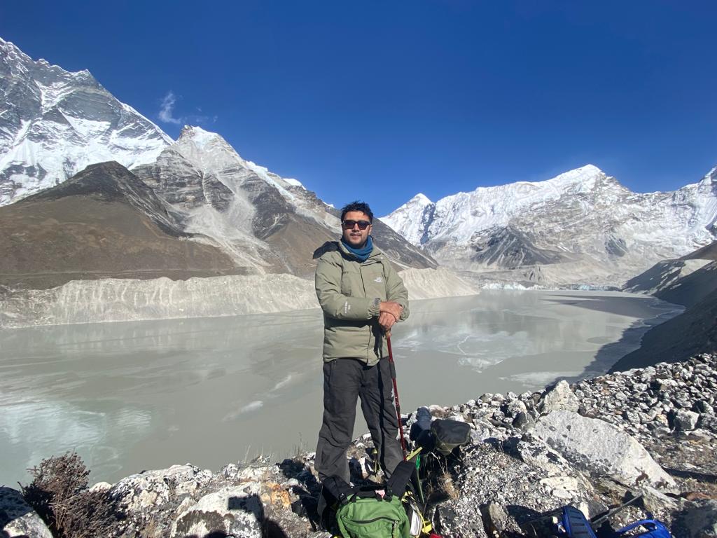
Nitesh Khadka at Imja Tsho glacial lake in the Everest region.
Highlights
Landslide runout and river connections in Nepal
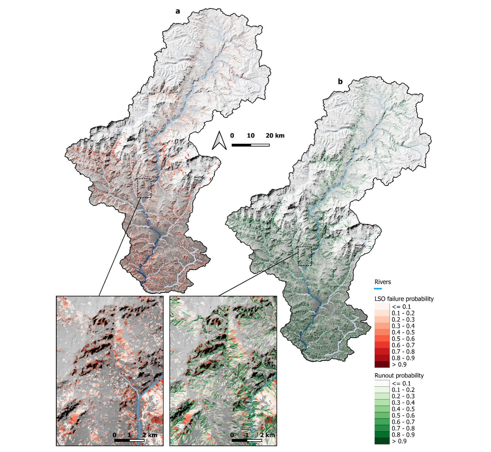
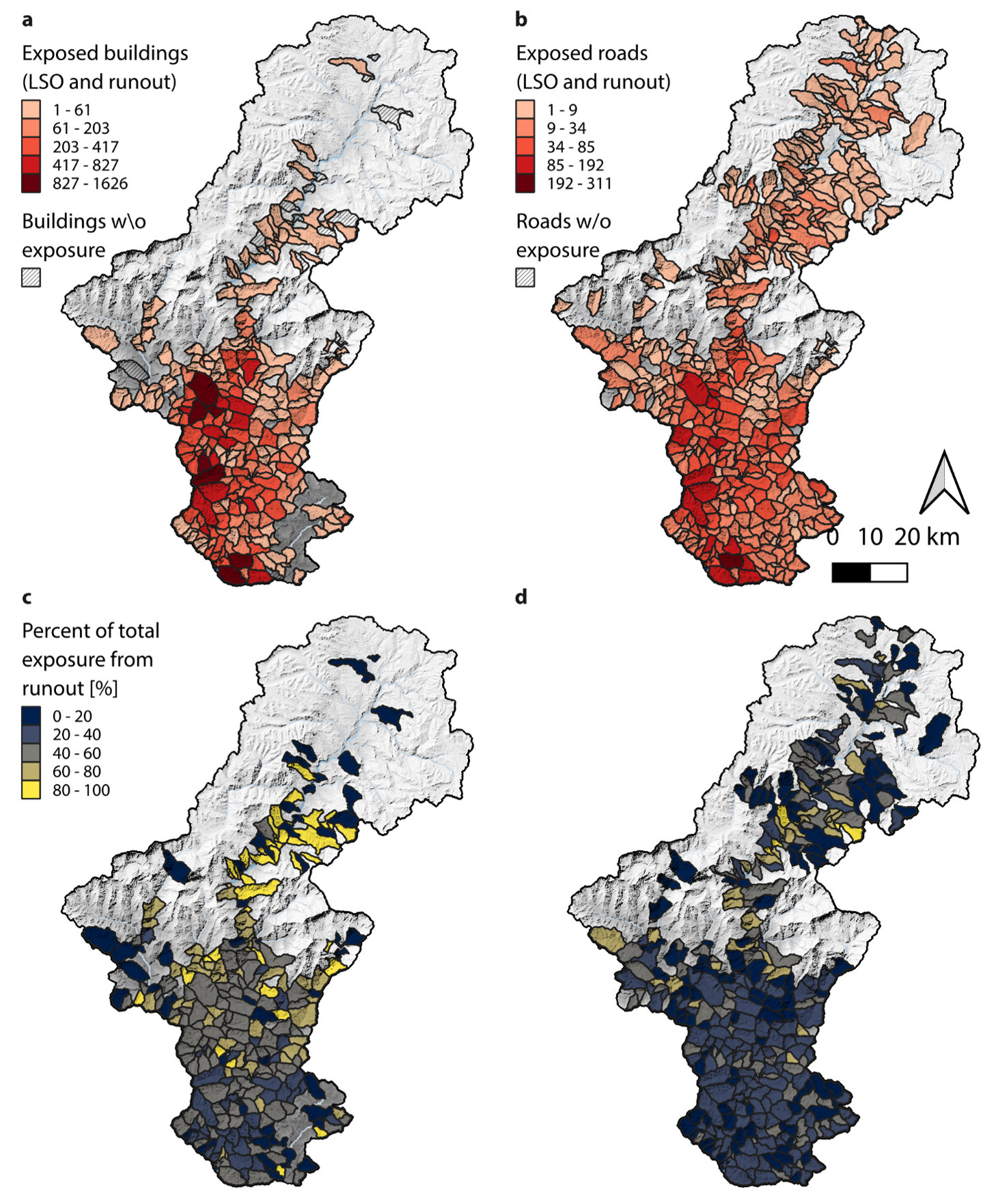
Schmitt, Bhandari, Vogl & Marc, Natural Hazards and Earth System Sciences (2026). Co-led by group member Shikshita Bhandari (Stanford University). A new framework maps about one million potential landslides in the Kaligandaki Basin, Nepal, and traces where each would run out. Runout enlarges the hazard area by about half, and a third of the landslides connect to rivers.
2026 Langtang Disaster on the China–Nepal border
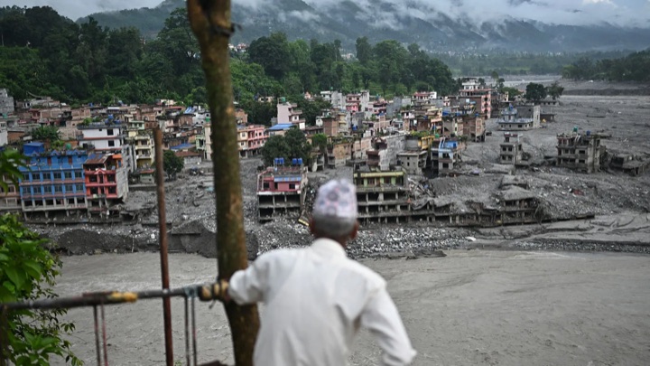
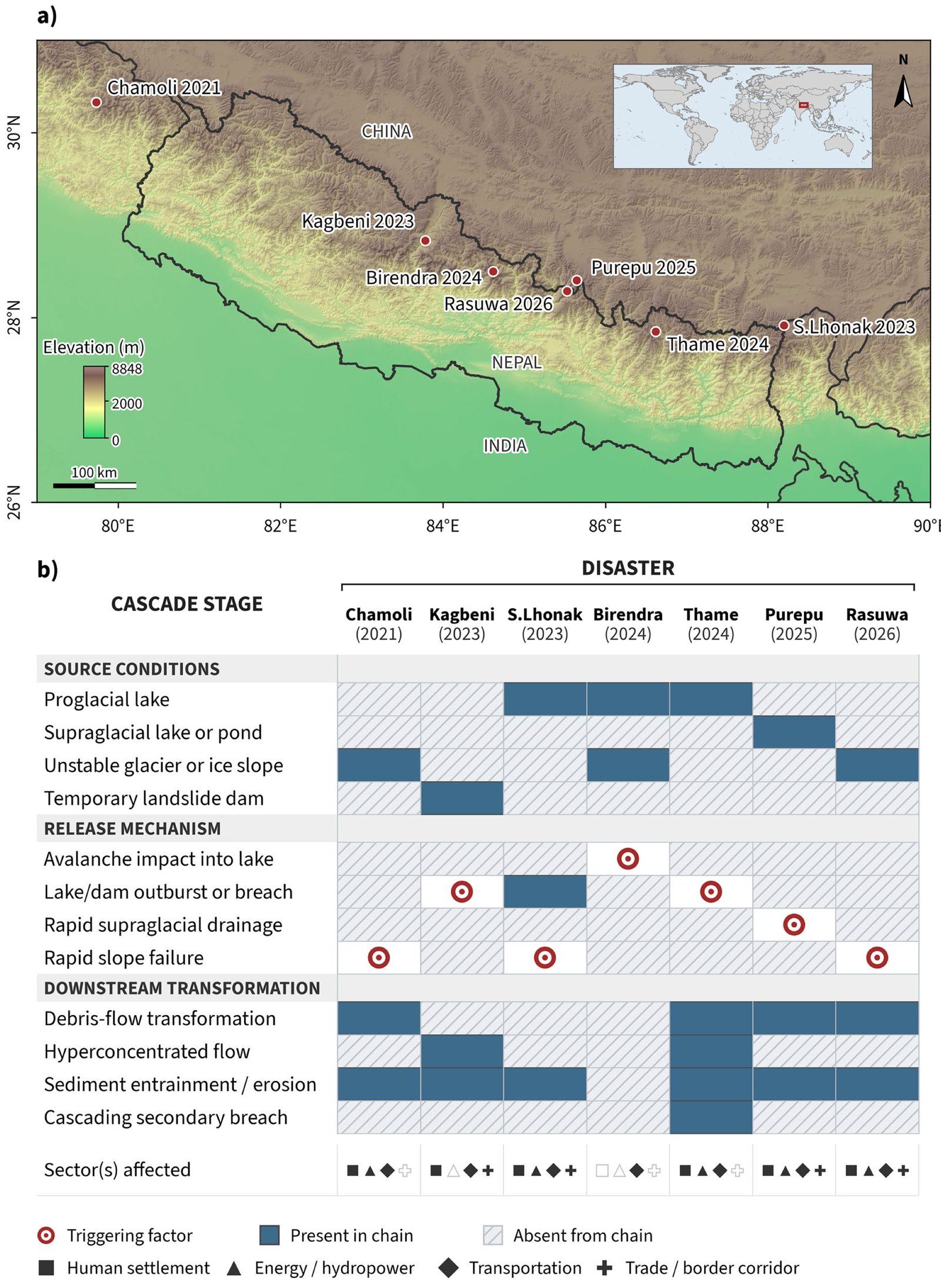
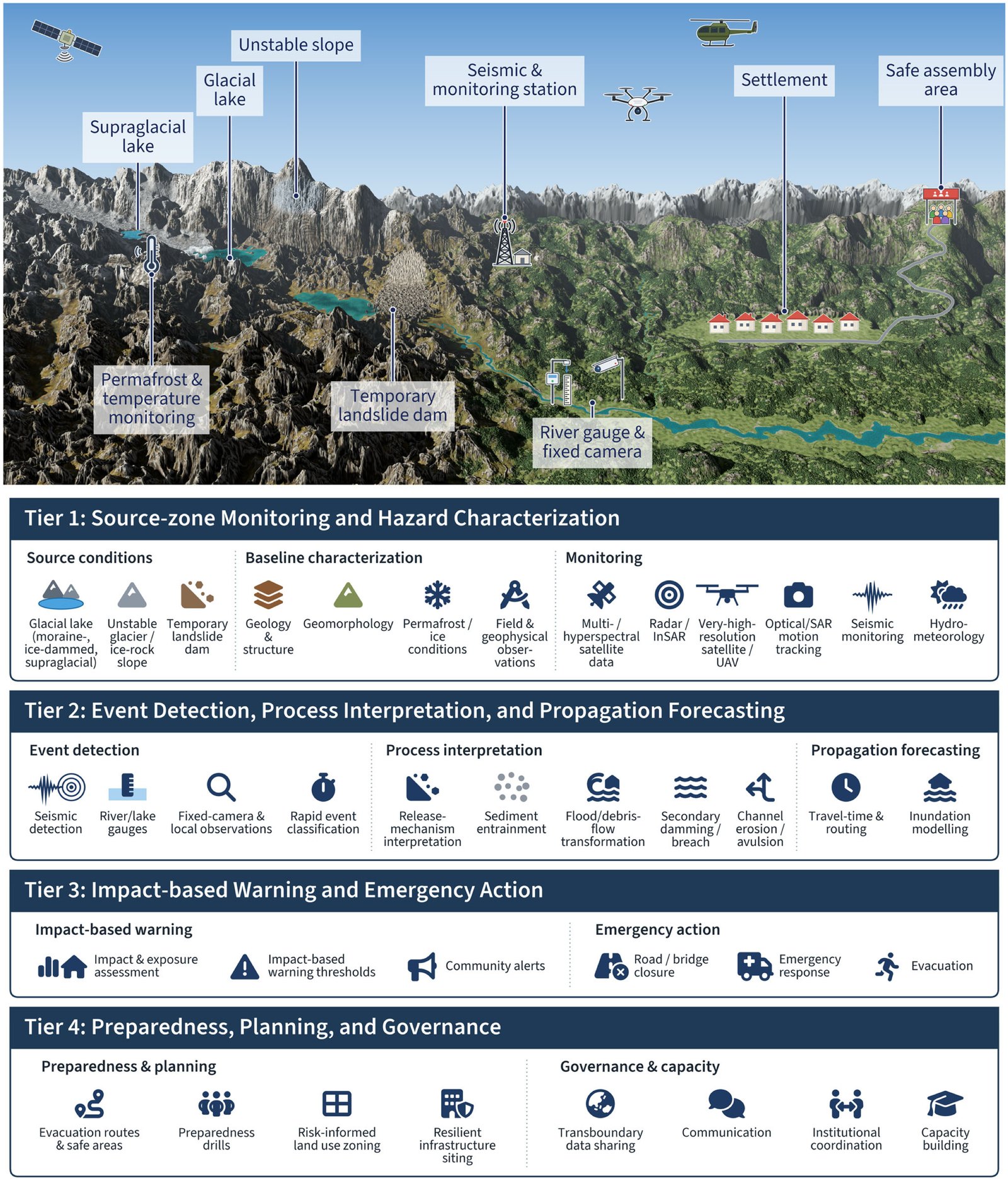
Cascading hazards and early warning in the Himalayas
Silwal & Dahal, npj Natural Hazards (2026). Seven recent disasters show that Himalayan floods begin through many cascading pathways, not only glacial lake outbursts.
From the Field
News
-
November 20, 2026
Shikshita Bhandari co-led COHESION: a connectivity-based framework for evaluating landslide susceptibility, runout hazards, and hillslope–channel coupling, now out in Natural Hazards and Earth System Sciences, with Rafael Schmitt, Adrian Vogl and Odin Marc. See the highlight.
-
November 06, 2026
Abinash Silwal and Kshitij Dahal’s perspective Rethinking cascading high mountain hazards and early warning in the Himalayas is now out in npj Natural Hazards.
-
September 30, 2026
Kshitij Dahal was interviewed by Science News for In the wake of the flood, could Nepal avert the next disaster?, on the August flood on the Nepal–China border.
-
August 28, 2026
Preliminary reconstruction of the 2026 Langtang Disaster
We reproduced the 26 August 2026 Langtang Disaster on the China–Nepal border in physics-based simulations. In this preliminary reconstruction the avalanche races down the gorge at over 150 km/h, and the flood it fed reaches Timure and Syabrubesi in about fourteen minutes at roughly 40 km/h.
Read more » -
August 26, 2026
FOX Weather interview on the 2026 Langtang Disaster
Kshitij Dahal spoke to FOX Weather about the devastating and unprecedented 26 August 2026 Langtang Disaster on the China–Nepal border (Rasuwa, Nepal). We are collecting information on the event, so please get in touch if you have observations to share.
Read more » -
July 10, 2026
Nitesh Khadka, Kshitij Dahal, and Manish Raj Gouli’s manuscript on data-driven GLOF susceptibility assessment along China–Nepal transportation corridors is in revision at the Journal of Geographical Sciences.
-
July 08, 2026
Kshitij Dahal was featured in the Early Career Spotlight of the AGU Hydrology Section Newsletter (July–August 2026).
-
May 20, 2026
The Times of India covered our GeoAI-based framework for assessing schools’ exposure to flood-depth scenarios (Bishui, Bera, Priyadarshi, Ghosh & Dahal, Natural Hazards).
People
Members














Biplav Khatri